1704 Home   Story Menu   Meet the 5 Cultures   People   Artifacts   Maps   Timeline   Voices & Songs   Explanations  

rule

Maps

rule

Maps are the physical manifestation of how Western societies view land. Some of the maps below were drawn in the early colonial period as Europeans struggled to understand and claim North America. Other maps were created for this website and offer several different visual and geographical perspectives on the peoples and events connected to the 1704 raid on Deerfield. Click a map's image or name to view it.


thumbnail image of map


The Raid on Deerfield, 1704
This map shows how the 1704 raid was conducted and its aftermath.

thumbnail image of settlement map

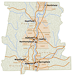
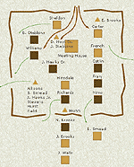
Settlement Patterns in the Connecticut River Valley
This map shows the changing populations in the middle Connecticut River Valley prior to and through the colonial period.

thumbnail image of map

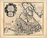
"Map of New France . . . made on its true meridian line by the Sieur de Champlain, Captain for the King," 1632
This map by Samuel Champlain shows North America from the northern regions to Virginia and from Newfoundland to Lake Superior.

thumbnail image of map

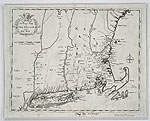
"A Map of New England," circa 1677
This map was created by John Foster and originally published in a history of King Phillip's War. It displays some of the English settlements affected by the conflict.

thumbnail image of map

"Carte du Canada ou de la Nouvelle France," 1703
This map, by Guillaume Delisle, shows France's colonial holdings in North America.

thumbnail image of map

"An Exact Mapp of New England and New York," 1702
This map was drawn by Cotton Mather, an influential and widely published Puritan minister from Boston.

thumbnail image of map

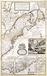
"A New and Exact Map of the Dominions of the King of Great Britain on the Continent of North America," 1711
This map by Herman Moll shows the newly conquered (in 1710) former French province of Acadia, renamed Nova Scotia (New Scotland) by the English.

thumbnail image of the March to Canada map

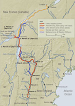
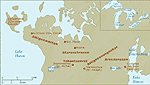
The March to Canada, 1704
This map shows the 300+ mile route that the English captives and their French and Native captors took from Deerfield to Canada.

thumbnail image of the Wobanakiak Homelands map

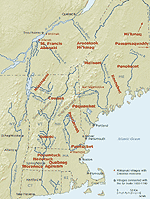
Wôbanaki Homelands, circa 1600
This map shows part of the territory of the original Wôbanaki homelands, in present-day Maine, New Hampshire, Vermont, northern Massachusetts, parts of southern Canada and the Maritimes.

thumbnail of wendat homeland map

Wendat Homeland, circa 1634
The original territory occupied by the Wendat was Wendake, a peninsula of land in Lake Huron.

thumbnail image of Kanienkehaka Homelands map

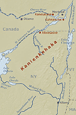
Kanienkehaka Homeland, circa 1600
Known as "the land of the flint," this territory in present-day New York state was traditionally called "Kanienkeh."

thumbnail image of map of the northeast 
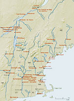
Colonial Northeast, circa 1660 - 1725
This map shows English and French settlements and centers of Native habitation at the time of the raid on Deerfield.
Northeast area map showing Native areas.

The Northeast Showing Native Homelands and Movements, circa 1650 - 1750
This map shows the traditional homelands of the Native groups involved in the Raid of 1704, and the locations of the communities they relocated to after being displaced by other Native and Colonial groups.

thumbnail of Deerfield landscape c. 1500.


top of page

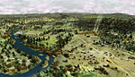
The Deerfield / Pocumtuck Area, circa 1550, 1700 and 1704
Images created from a 3D computer model of the area landscape that contrast the different styles of land use by the native Algonkian peoples and English settlers.

rule

About This Site   Resources   Glossary   Teachers' Guide   Site Map   How To  
© 2020 PVMA / Memorial Hall Museum